|
Maps from the history of
Horsted Keynes.
Horsted Keynes in 1947
We have just found a
fascinating aerial photograph of the village taken on
10th April 1947. Until we sort out whether we can reproduce a copy
on the village web site you can view it
via this link.
The download is almost 1 Meg so be prepared to wait if you don't have a
broadband connection.
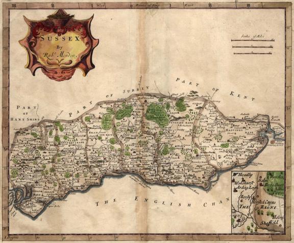
Morden's 1695 map of Sussex
In 1695 London bookseller Robert Morden produced
this map which is tiny by today's standards being little more than 6 inches
wide. Here we show a hand coloured version with an insert of of the area around
Horsted Keynes enlarged. This shows just how important the village was in those
days. Note, no Haywards Heath in sight - it would not appear until nearly 150
years later with the coming of the railways.
|
 |
If you want to see any of these
maps full size click the icon that appears briefly in the bottom
right hand side
when you put your mouse on the picture. This makes the image appear
as uploaded instead of being made to fit your screen by Windows. |
|
Tithe map, 1842 - click the map to view a
full size copy
 |
If you want to see any of these maps full
size click the icon that appears briefly in the bottom right hand side
when you put your mouse on the picture. This makes the image appear as
uploaded instead of being made to fit your screen by Windows. |
|
"Cor, look at all the roads!" Here is our first map of Horsted Keynes as it
was in the past. This is a reproduction of part of the 1842 tithe map of the
parish which shows roads, field boundaries and the more substantial buildings.
No doubt there were other hovels in the corners of fields but these didn't
interest the mapmaker.
Areas which are assumed to be water are shown in blue with the roads in red.
The long filled in village pond which is referred to in this article about boats
and boatbuilding in the village is shown on the corner of the road to Lucases
(sic) Farm. Perhaps the most obvious road which has now disappeared is the one which ran
from Ludwell past the old bakery and on to the road leading to Lucases (sic) Farm.
In fact part of it does still exist at the end of the gardens of the cottages in
Sugar Lane. Another obvious feature is the road North through Birch Grove: it
isn't there (as a road) anyway!
Whilst it is obvious why some of the developments occurred where they did
other buildings and roads seem to have sprung up literally in the middle of what
was then a field! Looking at the village though it did seem to make more sense
as it was with the road going through the village and then on to the obviously
large "Lucases" Farm.
The original of this map is held at the County Records Office in Chichester
and the copies are of very poor quality. As the reproductions made available to
us were totally unsuitable for use on the Internet, we have reproduced the map
here by tracing. Only the field numbers have been omitted as it was felt that
they would just fill up the map and make it far less clear. Finally, a caveat,
whilst we have made every effort to reproduce the map as clearly as we can,
errors may well have crept in so if accuracy is vital to you please go to
Chichester Records Office and look at the original map.
If you have or know where we can obtain other copies of maps or photographs
of this area in years gone by please do contact the webmaster, address and
'phone number below.
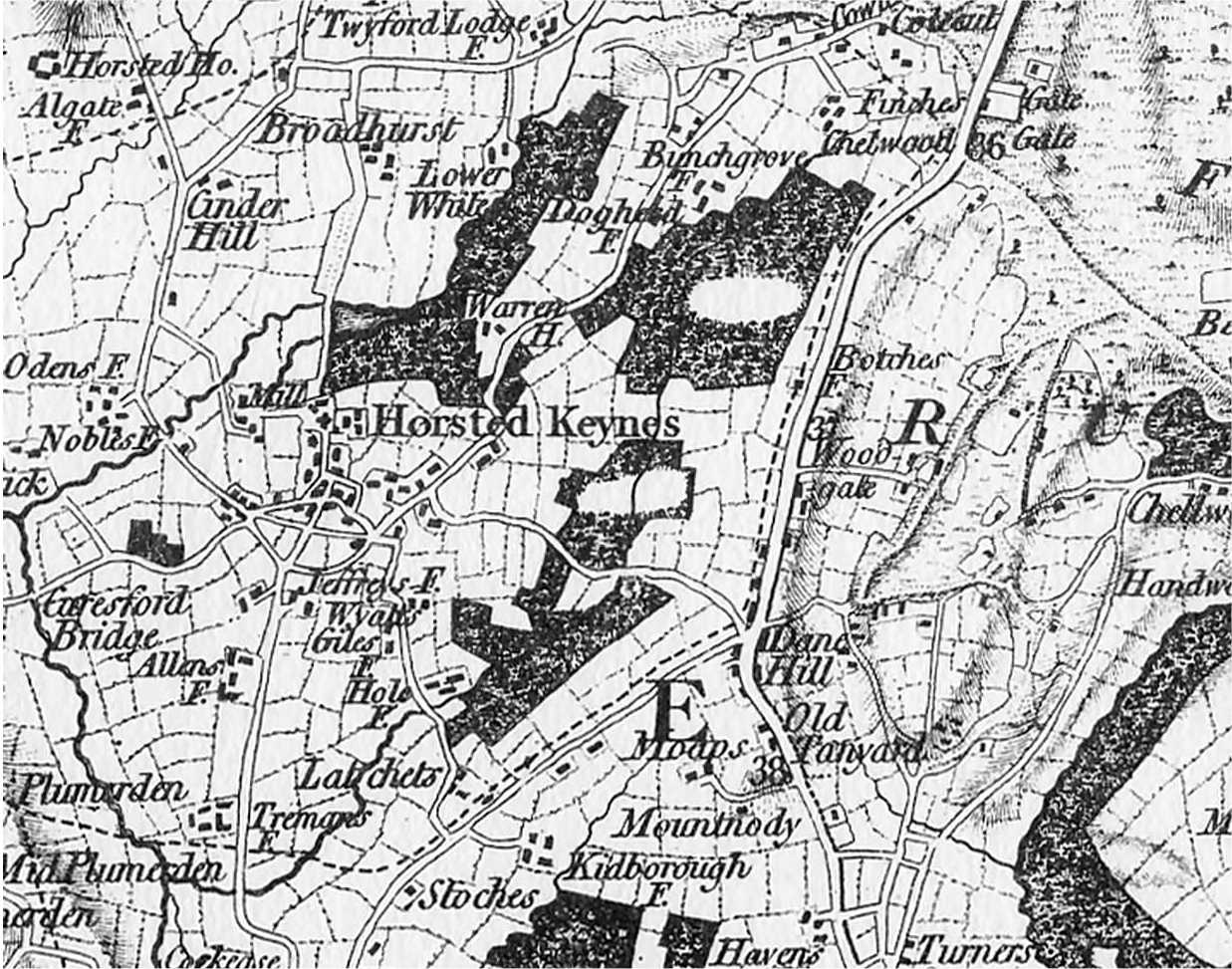
1795 Map of the village, before the railway!
|
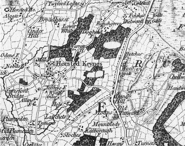 |
| A 1795 view of the area of Horsted
Keynes village. This looks very accurate as some of the field boundaries
still exist today. Click the image for a full size view. |
Pictorial history of
the Ouse Valley Railway

|

