|
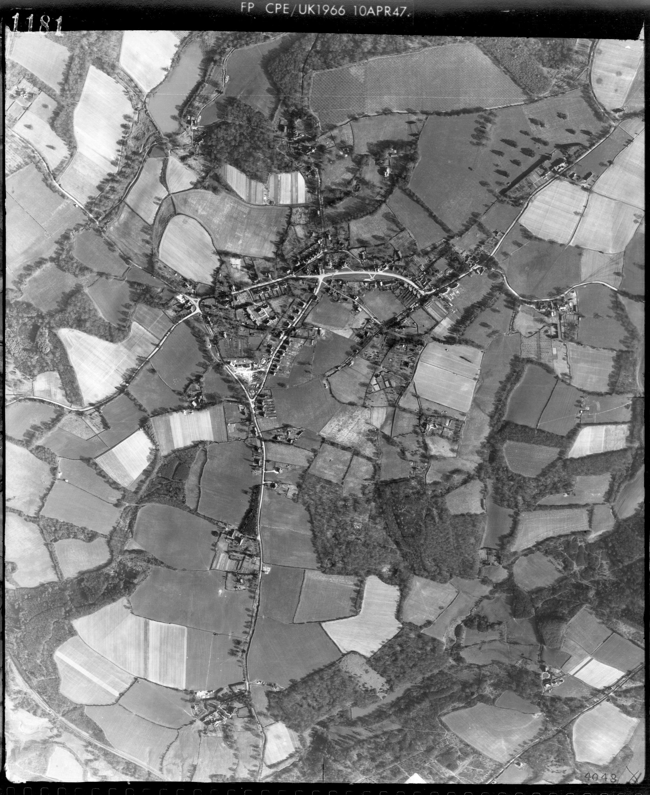
Horsted Keynes
in 1947
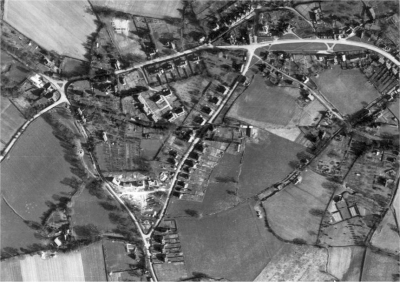
The original shows a much larger area in far greater detail.
We have just found a
fascinating aerial view of the village taken on
10th April 1947. Because the original file is no longer available on the
internet we have uploaded the best quality copy that we have available. Click
the picture above to take a look.
This was a very interesting time in the
history of our village. The war had just ended but modern development had not
yet started. There are numerous points of interest including a photo of the
Nisan hut in Station Road opposite the Martindale Centre where the Home Guard
trained during the war.
In the same part of the village you can
also see that they had just started work on the new estate on the corner of
Sugar Lane and Lewes Road.
It went on to become Jefferies.
Bonfire Lane stopped in the middle of a
field; Hamsland and Challoners being still just a twinkle in the planners eye!
Remember, when downloaded the photo will look tiny on
your browser window, but if you click anywhere on the screen it should expand
to full size from where you can zoom in to see a greater amount of detail.
|